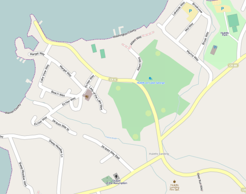
A map of Huletts Landing from Open Street Map.
Many thanks to Jim McAndrew who created the following map of Huletts Landing including street names and a high level of detail. I don’t think there’s another map out there detailing all the individual street names in Huletts.
There is also quite a bit of useful detail on other portions of the map, showing camping islands, picnic areas, buoys and trails around the lake.
This is such a helpful resource, I’m going to include it on the left sidebar.
Thanks Jim!
Click on the picture to see map.