
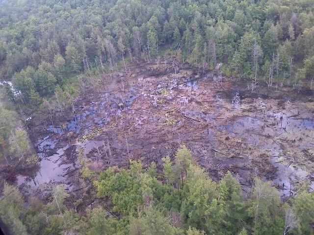
The area of the beaver pond (that is believed to have caused the 2013 Foster Brook flood) after the dam break (LGPC-DEC-State Police Photo). (Click picture to see larger view.)
During the midst of the 2013 summer Foster Brook flood, the thought running through my mind was; “Where is all this water coming from?” There had been no rain for days and there weren’t any flood warnings in effect. The day was mildly cloudy. The flash flood came down the mountain suddenly, severely eroding the area of Foster Brook while also jumping the bank and causing damage to nearby roads and homes.
Well, thanks to Randy Rath, of the Lake George Association, here is a Google Earth map showing exactly where the water supposedly originated.
It is believed that the flood was started by a beaver dam failure constructed on the upstream pond pictured in the center of the Google map. The water held back by the dam was estimated at about 9 +acres and was all but entirely drained after the dam washed away. The resulting sediment washed down into Lake George was thus ultimately believed to have been caused by wild beavers.
What can be done to prevent this from happening again? Well according to Bob Banks, Town Supervisor of Dresden, the town does have funds available in its yearly budget for beaver dam removal. The problem was that no one knew about this area. To keep it from happening again, the area would need to be monitored to see if the area is being “dammed” again, resulting in a water buildup.
At least the question; “Where did the water come from?” may now be answered.